
Author’s Map of the Ancient State Urartu // Postcard


$2.60 Buy 10 to get 15% discount
Painted by a young artist from Gyumri, Armenia.
The map is printed on decorative cardboard and includes a craft gift envelope.
10% of sales will be directed to the development of artistic practice in Armenia.
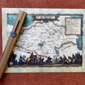
Founded in 861 BC, Urartu was an Iron Age kingdom centered around the Armenian highlands between Lake Van, Lake Urmia, and Lake Sevan. The territory of the ancient kingdom of Urartu extended over the modern frontiers of Turkey, Iran, Iraq, and the Republic of Armenia.
Historically accurate, this map was painted by a young artist from Gyumri, Armenia and was created exclusively for the HaK’artez project. The map is printed on decorative cardboard and includes a craft gift envelope.
10% of sales will be directed to the development of artistic practice in Armenia.
Additional information
| Weight | 0.1 kg |
|---|---|
| Dimensions | 15 × 11 × 0.1 cm |
-
 $24.00 Buy 2 to get 5% discount
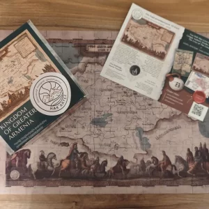
Author’s Map of the Kingdom of Greater Armenia in Golden Tube (38 x 28 cm)
$24.00 Buy 2 to get 5% discount


Reviews
There are no reviews yet.